


2% Paved
20% Dirt road
78% Singletrack
90% Percent rideable
Longest stretch between resupply: 95 miles, 3-4 days
Longest stretch between water sources: 45 miles, 2 days
Physical difficulty: 8/10
Technical difficulty: 7/10
Bikepacking challenge: Advanced
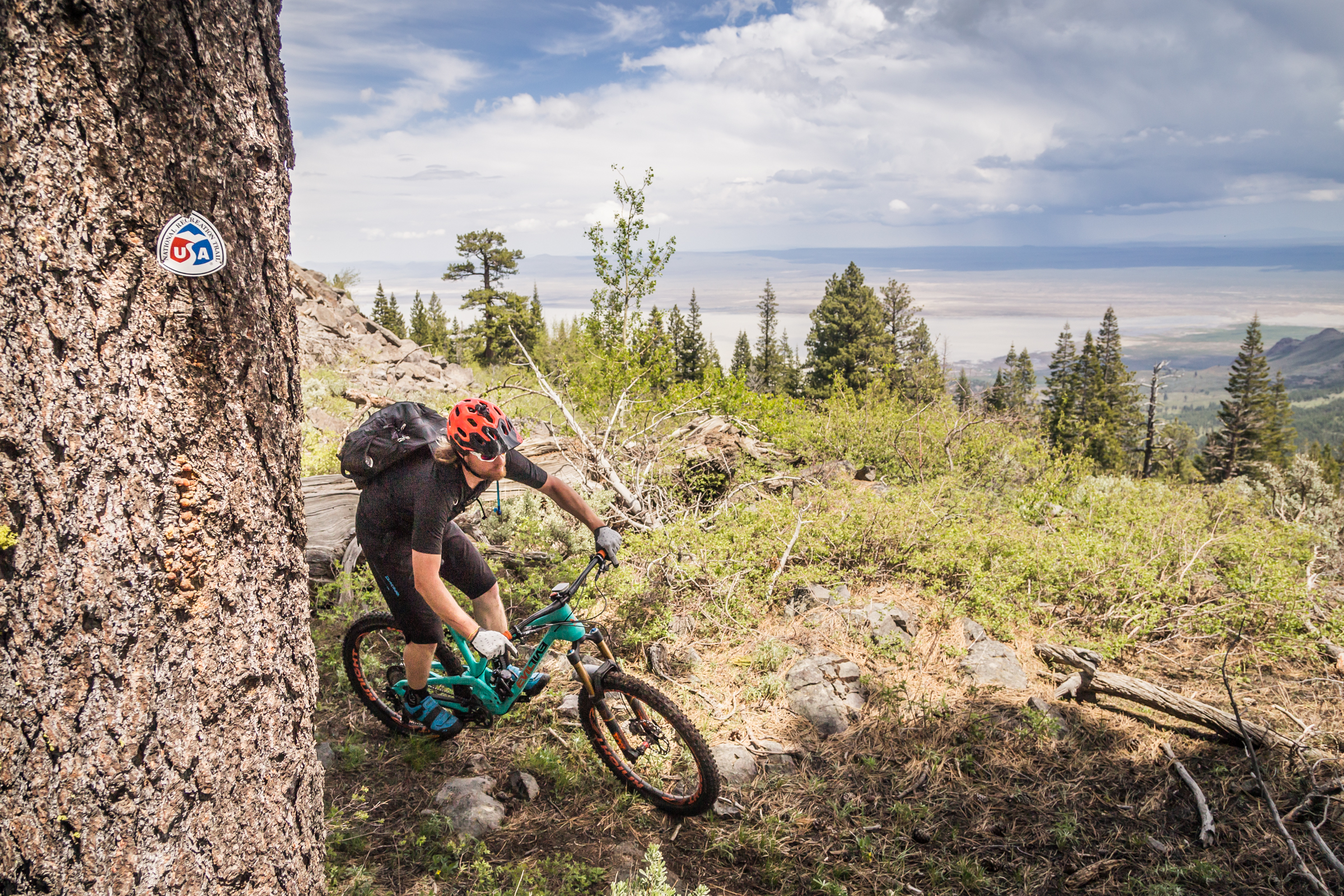
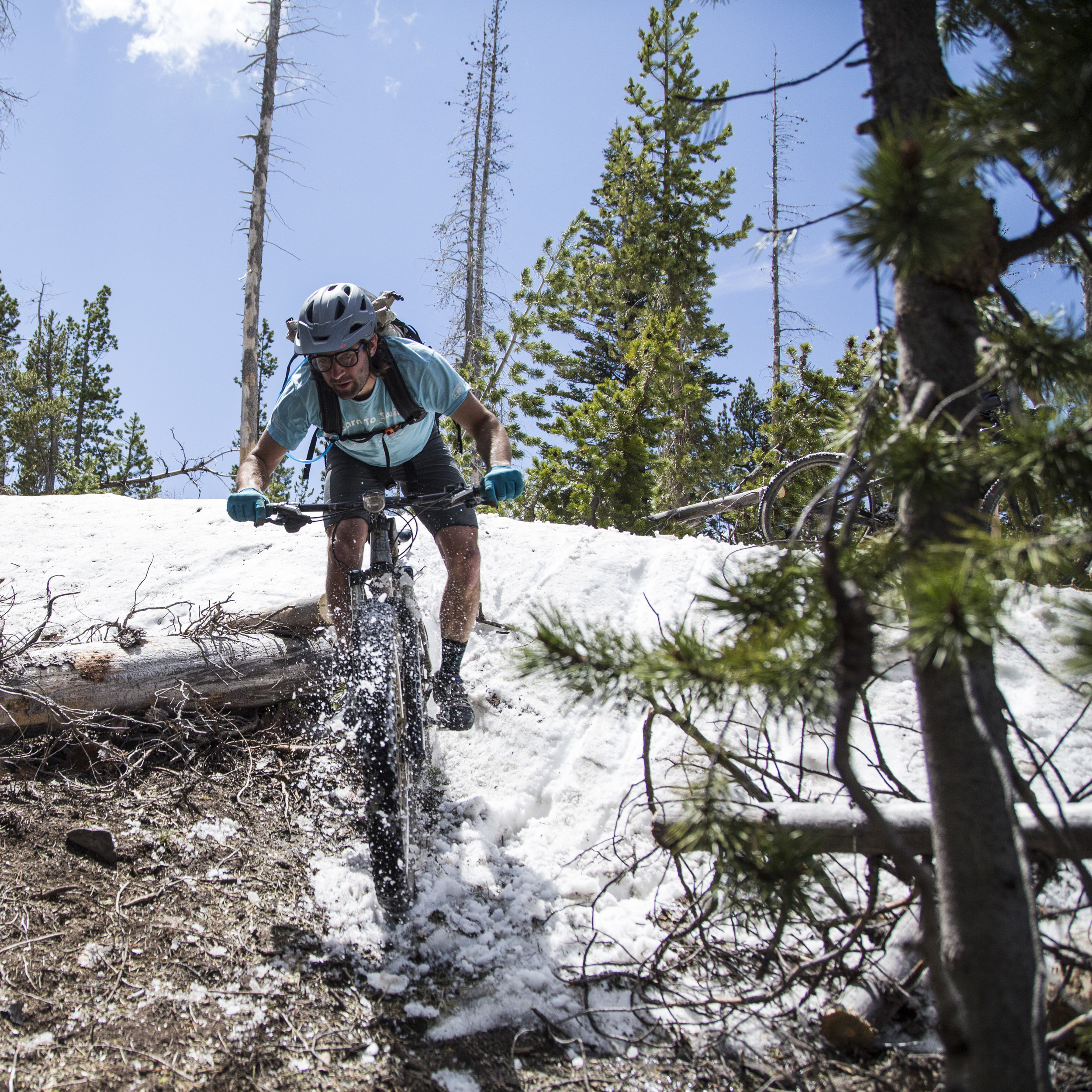
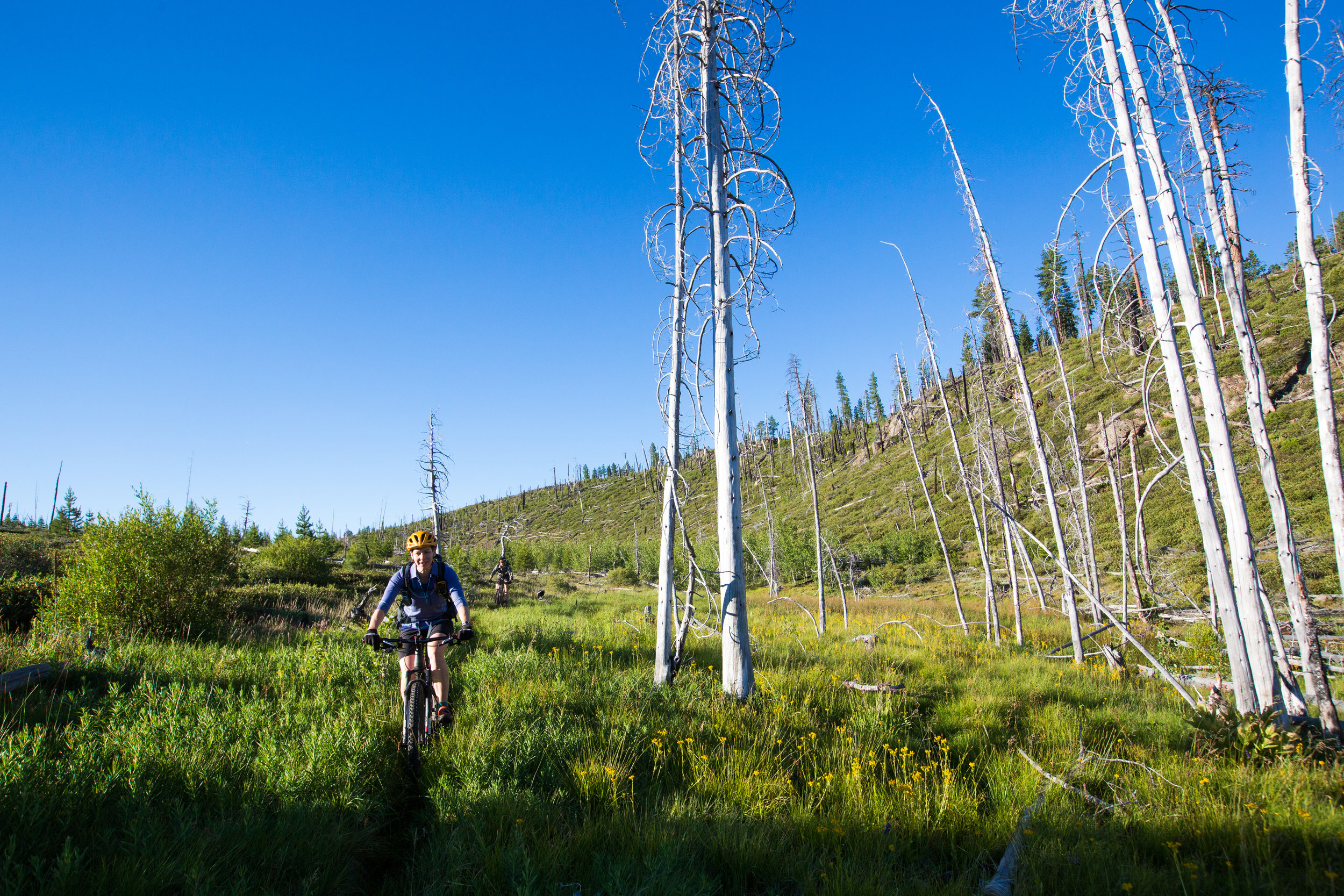
The Fremont tier of the Oregon Timber Trail starts in the middle of nowhere near the California border. Starting a few miles south of the border you’ll travel north along the spine of the Warner Mountains on the Crane Mountain National Recreation Trail and then west along high mountains overlooking the playas of Summer Lake and Silver Lake on the Fremont National Recreation Trail Polish it off with the long trek up and over Yamsay Mountain, a volcano from long ago.
“ I found the whole Fremont section to be uniquely rugged, varied, and kind of whimsical...the solitude was stunning.”
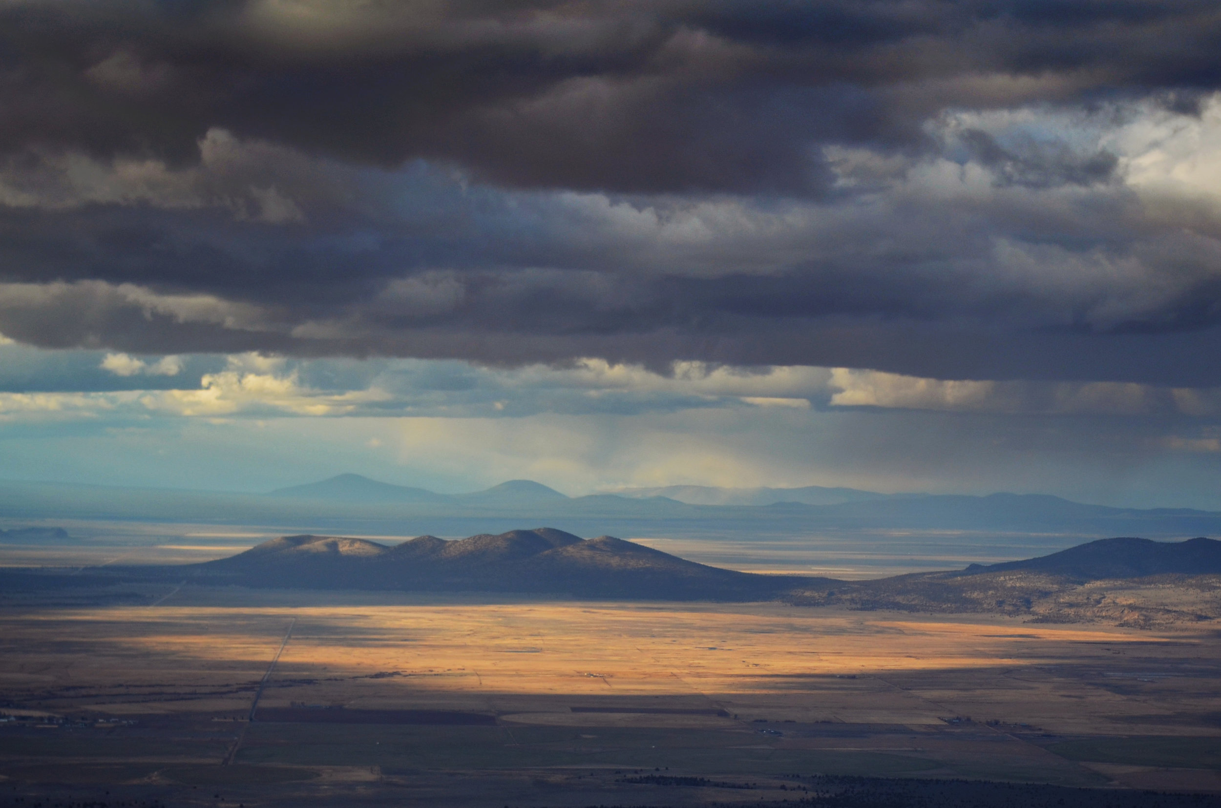
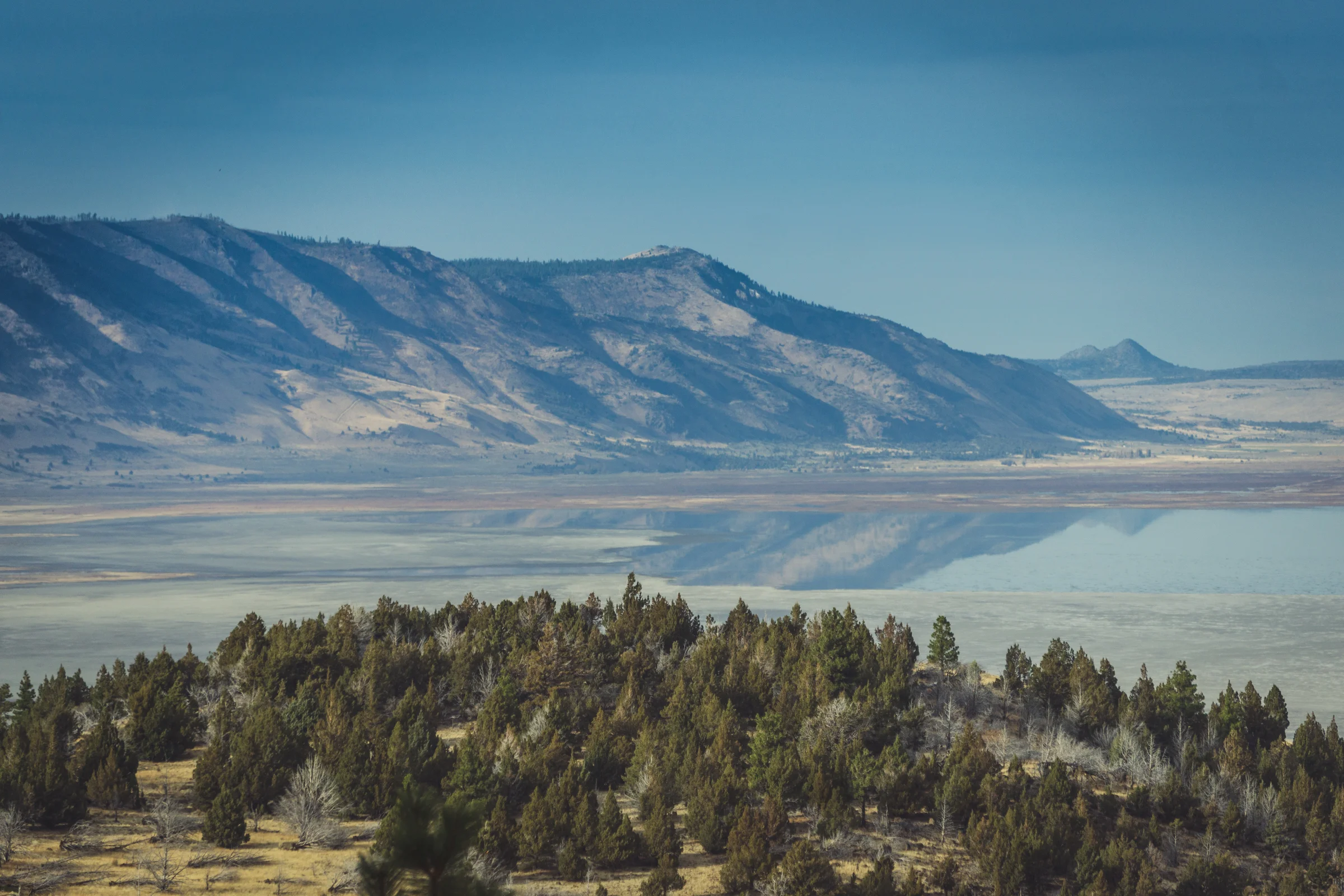
The Fremont Tier is one of the most challenging and perhaps the most rewarding of the OTT. The secluded landscapes you’ll pass through are varied and expansive. Large lakes once dominated the basins between the mountain ranges but have receded considerably since the last periods of the ice age. Today, the basins are dry playas and lake remnants.
Archeological studies of the Paisley Caves on the edge of the Summer Lake playa near Paisley indicate human occupation of the area going back at least 14,000 years. Undoubtedly, the lake margins provided food and refuge from the harsh winter weather in the adjacent mountains. Bird life is abundant where water still exists.
Cattle grazing is ubiquitous, both in the mountains and valleys. Water diverted from the rivers and streams to irrigate pastures in the valleys creates a touch of green to an otherwise brown landscape. The adjacent high mountains are green forests and meadows, with swathes of dead trees due to recent wildfires.
The elevation of Crane Mountain just north of the California border is 8,200 feet and the highest point in this Tier. The route generally follows high ridges throughout the Fremont Tier and these are 6000 to 8000 feet in elevation. The adjacent valleys are at 4,500 feet.
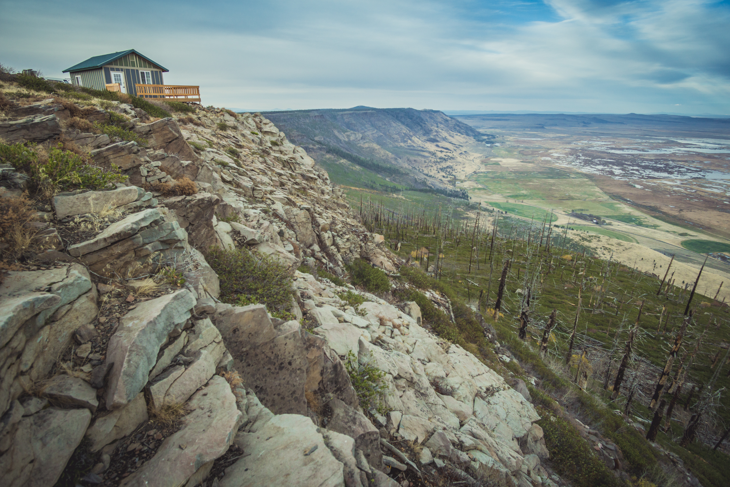
Some of the higher peaks have old lookouts that can be rented for the night from the Forest Service. These include the ones on Drake Peak, Bald Butte, Fremont Point and Hager Mountain. The Currier Guard Station cabin along the Sycan River can also be rented.
Highlights
Lily and Cave Lake - The southern tip of the route begins at these two alpine lakes
Crane Mountain - The highest elevation on the OTT at 8,200 feet
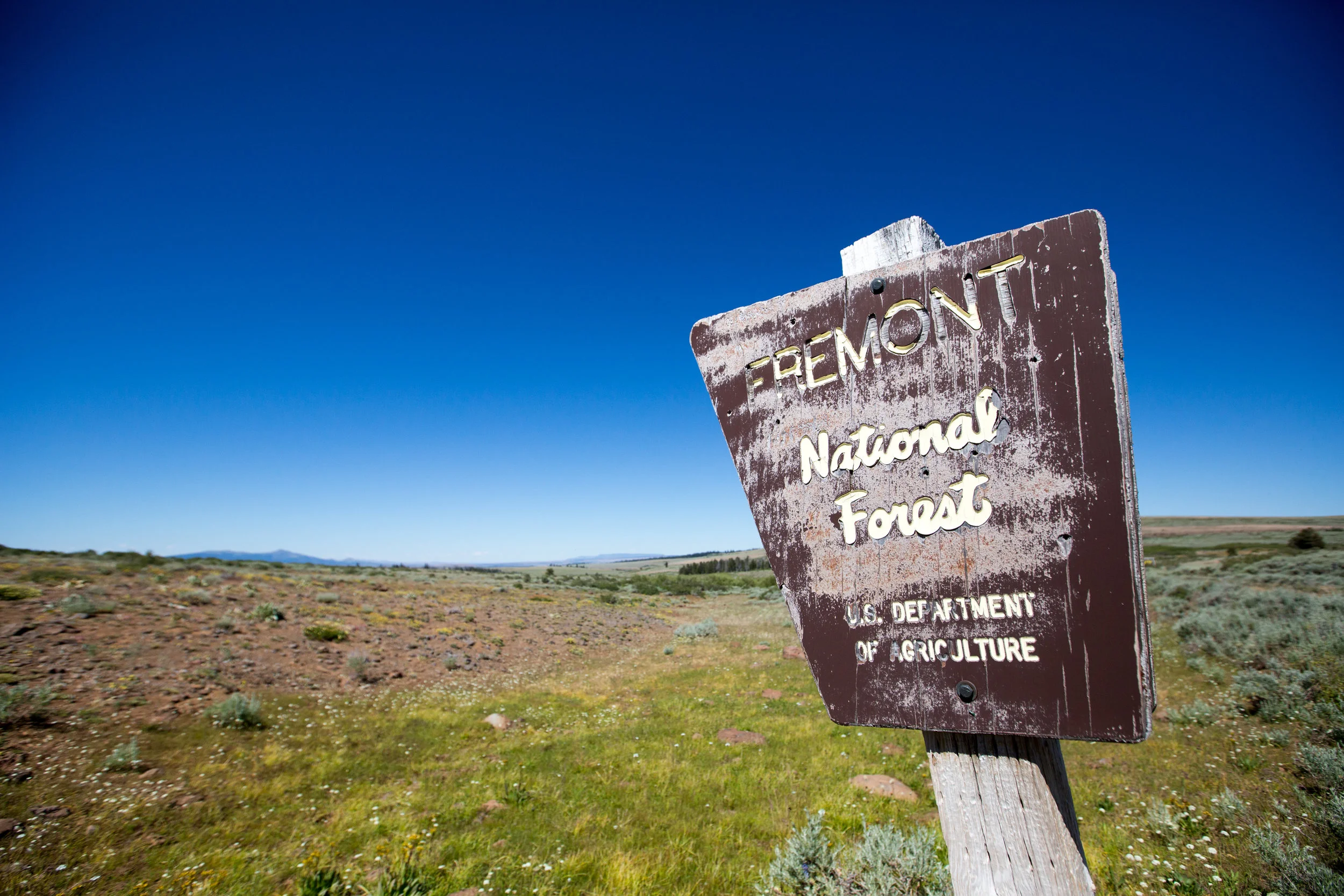
Fremont National Recreation Trail - a lightly-used and stunningly scenic trail spanning south-central Oregon
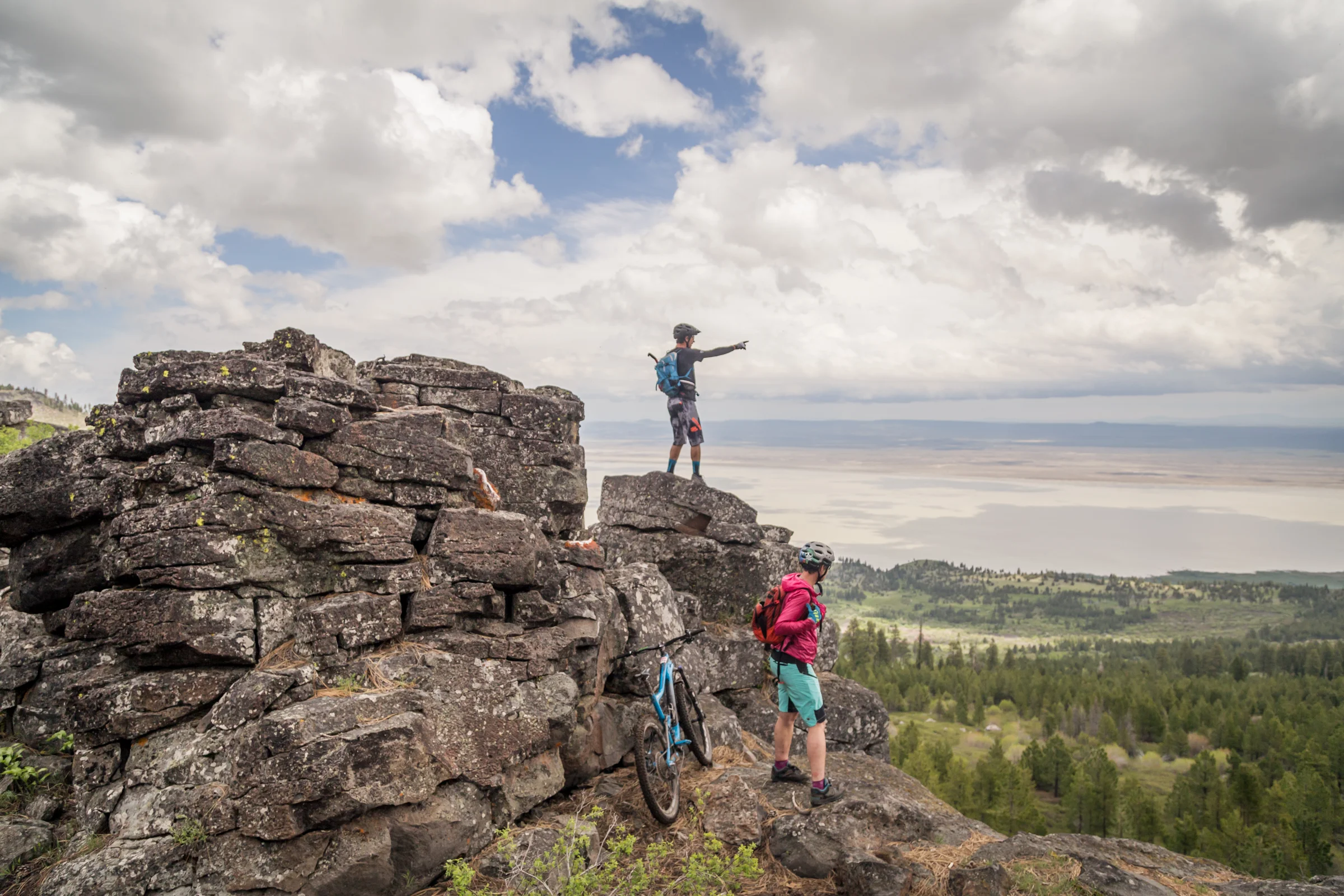
Round Mountain - Open ridge line riding with views of prehistoric lake beds and Gearhart Mountain
Chewaucan Valley - A small river draining flowing through the forests of the Fremont National Forest
Winter Rim - A 3,000 foot high north-facing escarpment with stunning views.
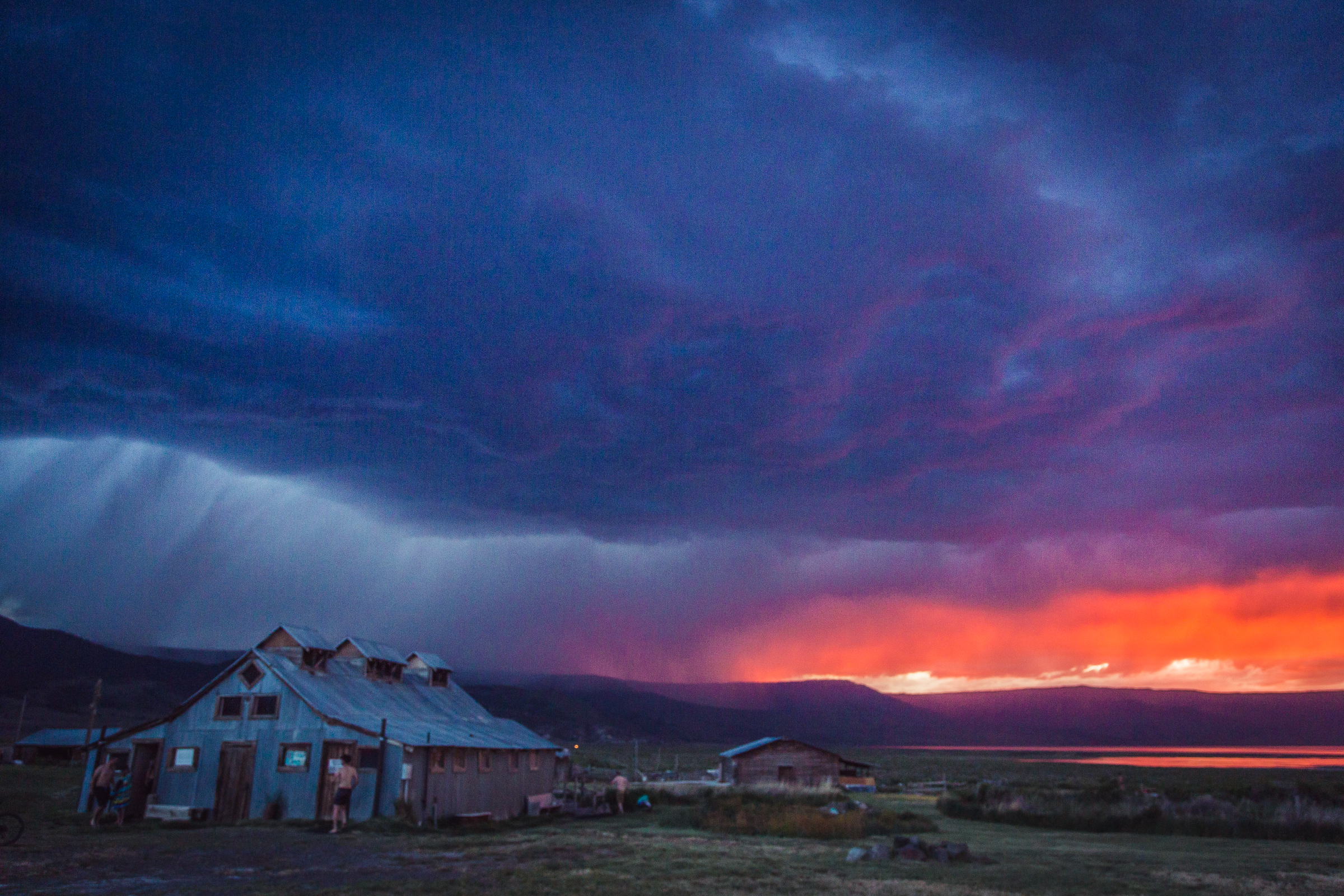
Summer Lake Hot Springs - Relax in the warm mineral waters and historic ranch buildings
Cowboy Dinner Tree - Legendary backwoods diner
Silver Lake resupply - Quiet town of Silver Lake for supplies
Rentable forest service lookouts - Reserve a night or two at one of six Forest Service cabins and lookouts along the route
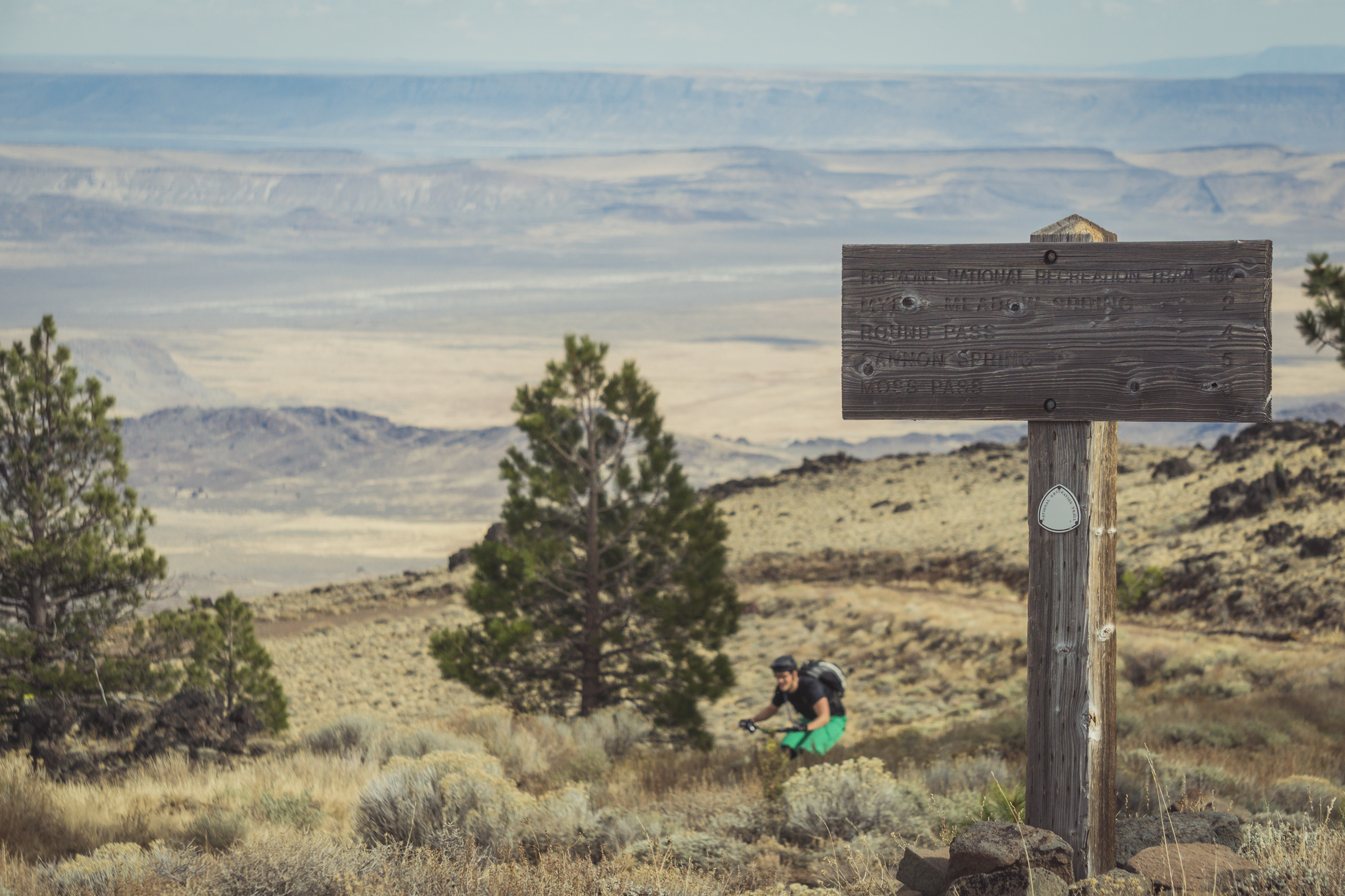
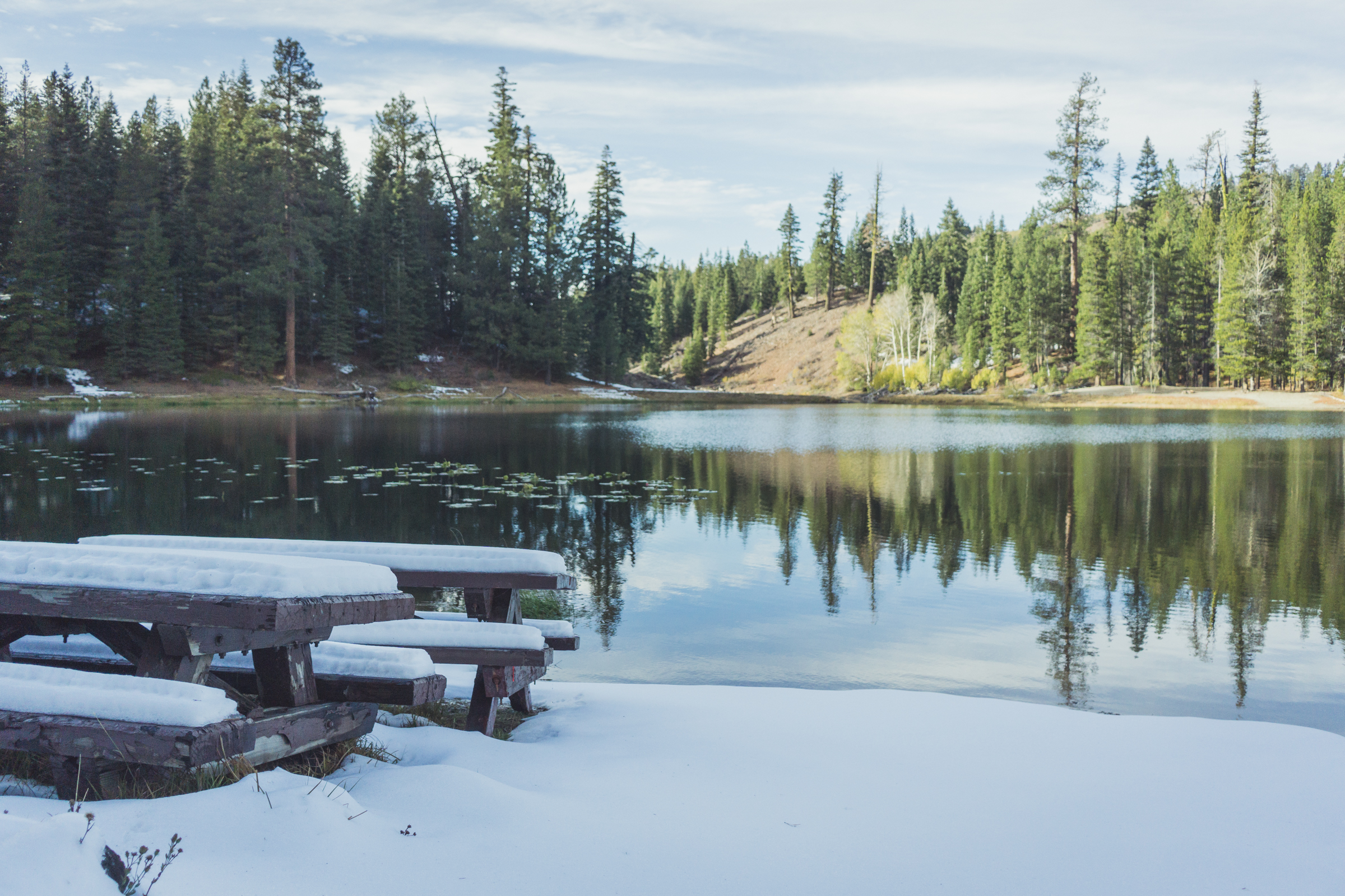
Moss Pass © Leslie Kehmeier
Logistics
The start of the trail is Cave Lake near the Oregon/California border and it’s in the middle of nowhere. Lakeview, a town of 2,000 people, is 15 miles to the northwest, about a 45 minute drive. See the “Getting There” section at the beginning of this guide for options getting to the start.
The Fremont Tier is remote with few resupply points. Water sources are few. The trails aren’t well maintained and often steep so forward progress can be slow. Navigation is challenging because low trail use, interlacing cattle paths, and recent fires often obscure the trail tread. Summer thunderstorms can include lightning. For all these reasons, riding this tier requires a higher level of planning and attention to details.
That’s not to suggest that riding this tier is perilous. The trail periodically intersects roads that lead downhill to the small towns of Lakeview, Paisley, and Silver Lake. You will occasionally encounter people driving the roads or hiking on the trail. And there are those who work put there who will be using the roads. Most will be more than willing to help out a biker in distress.
A primary safeguard is to carry more than enough water to get to the next reliable source. Food is available only in Lakeview, Paisley, and Silver Lake and none of these towns are on route so carry a lot with you. Your forward progress each day may be less than anticipated due to the challenging terrain and trails so plan accordingly.
Trail & Forest info
Fremont–Winema National Forest - (541) 947-2151
Recommended maps
USGS Topographical Quadrants available at USGS.gov
Fremont-Winema/Upper Klamath Basin - 1/2”, 2006
Bike shops
Tall Town Bike and Camp, Lakeview, OR - (503) 314-6095
Zach’s Bikes, Klamath Falls, OR - (541) 851-9200
Nearest medical facilities
Lake Health District
700 S. J St. | Lakeview, OR 97630 | (541) 947-2114
Sky Lakes Medical Center
2865 Daggett Ave. | Klamath Falls, OR 97601 | (541) 882-6311
St. Charles Medical Center
2500 NE Neff Road | Bend, OR 97701 | (541) 382-4321
Law Enforcement
Lake County Sheriff: (541) 947-2504
Klamath County Sheriff: (541) 883-5130
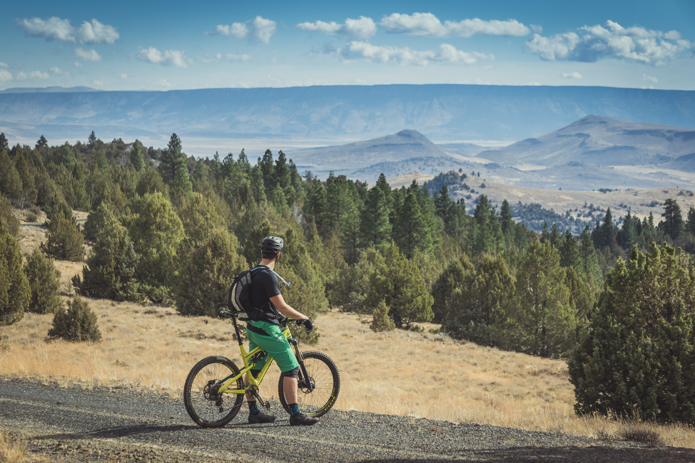
Fremont National Forest © Leslie Kehmeier
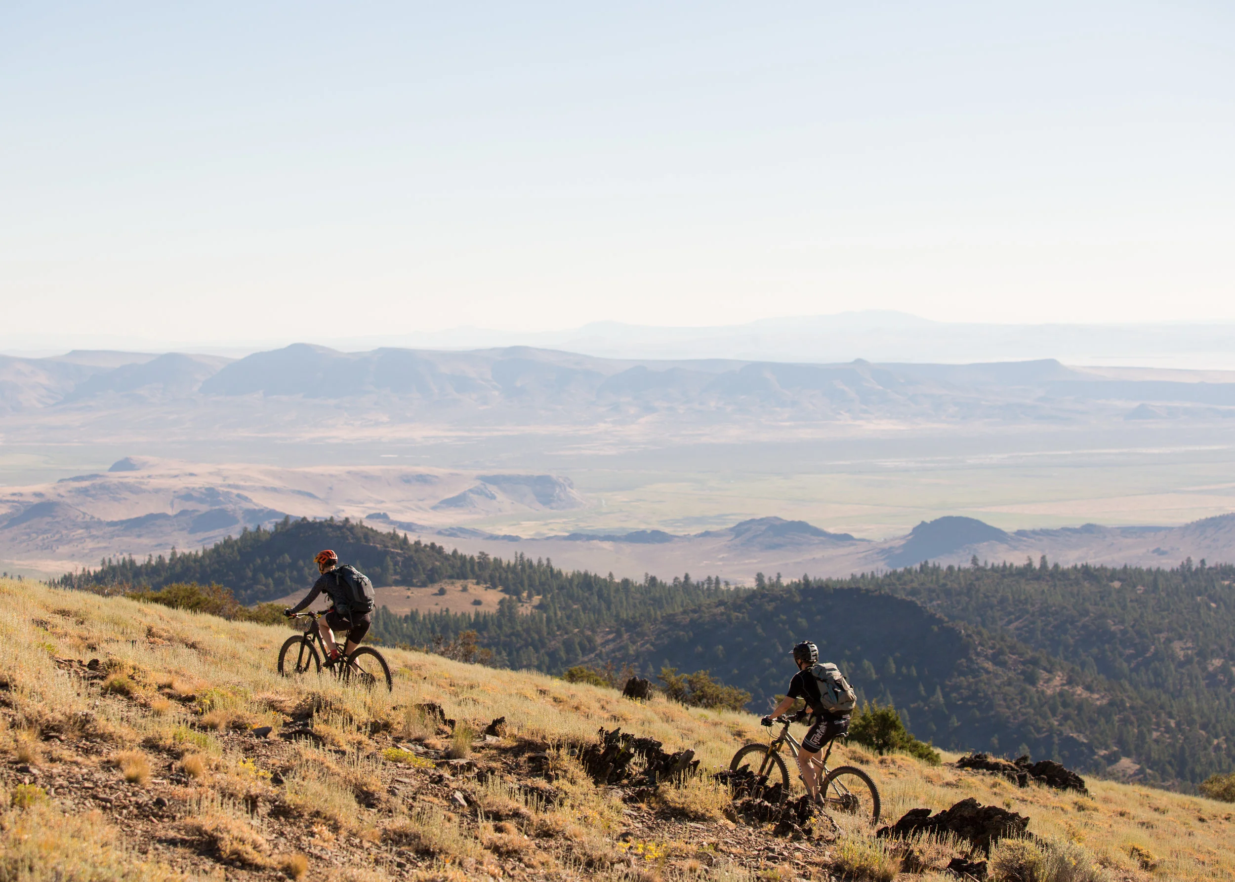
BASIN AND RANGE
Segment 1 of 10
Lily Lake to the Chewaucan Valley

Goose Lake from Crane Mountain © Leslie Kehmeier
Segment length: 91 miles
Total climbing: +11,873 feet
Number of days: 3-4
7% Paved
15% Dirt road
78% Singletrack
95% Percent Rideable
Physical difficulty: 9/10
Technical difficulty: 6/10
Bikepacking challenge: Advanced
Longest stretch between resupply: 98 miles, 3-4 days
Longest stretch between water sources: 24 miles, 1 day
Resupplies
Mile 0: Lakeview (before starting) - Full services, Safeway
Mile 91: Paisley (7 miles off route) - Limited services, Paisley Mercantile, Pioneer Saloon, Homestead Cafe
Commercial Lodging
Mile 0: Honker Inn Lodge
Mile 27: Squirelville lodge
Mile 91: Paisley Sage Rooms
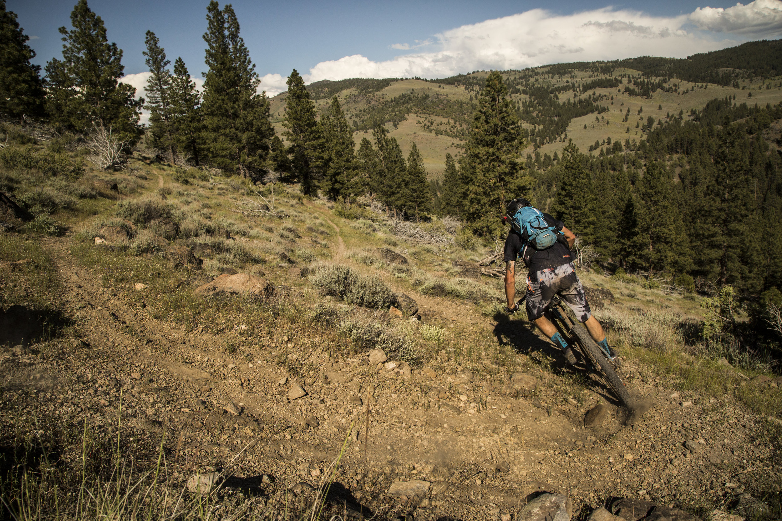
The first segment of the Oregon Timber Trail begins high in the Warner Mountains just south of the California border. You’ll be riding north along rocky ridges of the Warner Mountains among meadows and forest with views of far off volcanoes; Mount Shasta to the southwest and the Three Sisters to the northwest.
This landscape is often referred to as basin and range. High mountain ranges - usually trending north to south or east to west - are separated by broad valleys, many of which are ancient dry lake beds.
Historic and current use of this basin and range country follows these contours. Mining occurs mainly in the mountains, alongside timber harvesting and summer grazing. Irrigated pastures, hay fields, and winter stockyards are in the valleys. Most people live in the small valley communities.
The mountain vegetation varies considerably with elevation, aspect, recent fire history, and insect infestation. Higher elevations and north-facing slopes are moist and support dense forests of lodgepole pine, Douglas-fir, and white fir, while the drier south-facing slopes at lower elevation trend towards ponderosa pine, manzanita, and grassy meadows. Recent fires have affected large swathes of the Fremont-Winema National Forest so you will be riding through charred trees at times. The fires have been exasperated by an infestation of bark beetles that kill the lodgepole pine in large numbers. If you encounter a log that has fallen across the trail it is likely to be a bug-killed lodgepole pine.
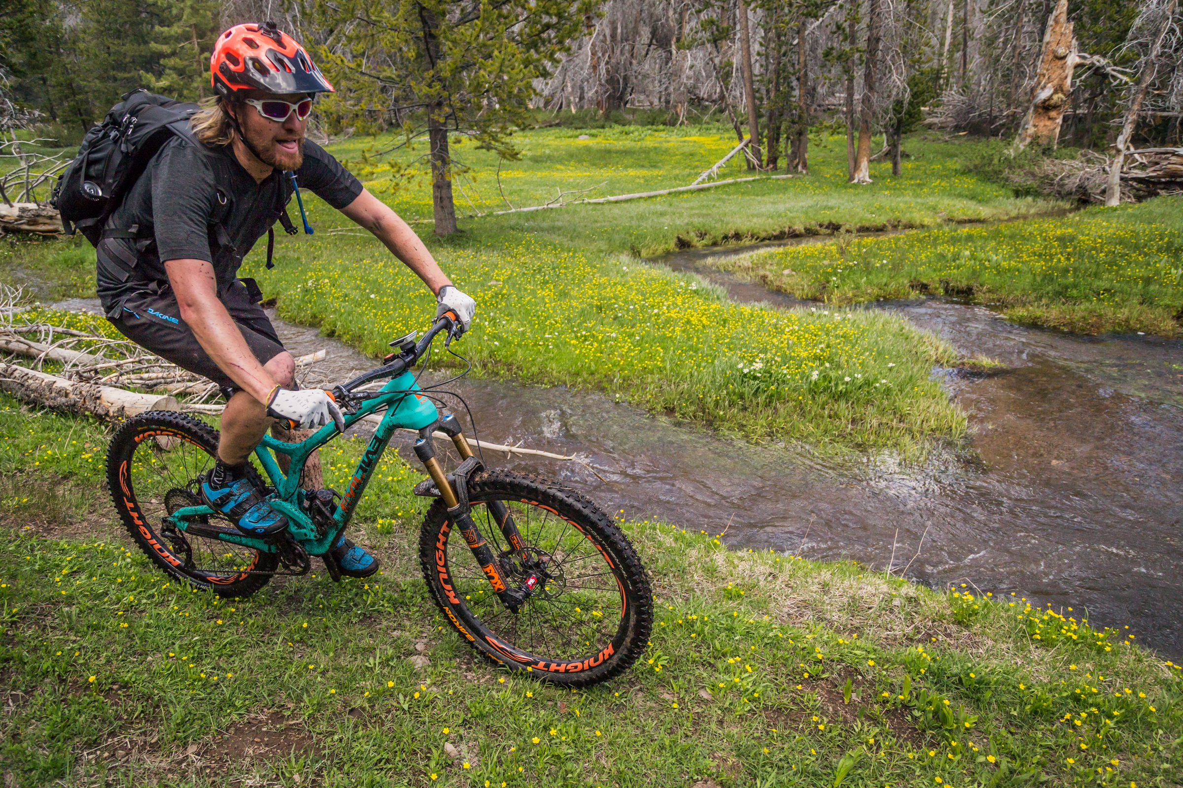
Springs and wet meadows along rivers and streams have their own unique vegetation. Especially delightful are the groves of quaking aspen. Water attracts wildlife so it is where you will most likely see birds, deer, elk, bear, and antelope. Free-range cattle also congregate around water so these areas can be heavily disturbed by grazing.
Your adventure begins at the Cave Lake boat ramp. Follow a steep logging road for 3 miles to a pass and will take you the route climbs for about three miles on forest roads before turning into faint trail rolling up and down over Crane Mountain. The first reliable water source, Camas Creek, lies at mile 27 but if you detour to the east off of Crane Mountain at mile 12 on NF4011, Willow Creek Campground is a nice primitive campground with vault toilets and a mountain stream. Rejoin the route by following NF3915 to Rogger Meadows. At mile 26, just before crossing the Warner Highway there’s the rustic Squirrelville Lodge, available to rent.
After crossing Warner Highway and a short climb you can choose to stay on the ridge route or detour towards Bull Prairie and Drake Peak. A few miles off the route on NF3615 you’ll find Mud Spring Campground with potable water and toilets. Nearby is the rentable Aspen Cabin; or the really adventurous can climb to Drake Peak Lookout (rent in advance). From here, follow Crooked Creek for a stunning 7 mile descent back to relative civilization on Highway 395. Don’t forget to fill up on water at the Crooked Creek Mill Trailhead, the next reliable water is 25-miles away.
Ride south for about 3 miles on Highway 395, and then turn north once again and climb to reach Cox Pass Trailhead, Moss Pass, Round Mountain and the spectacular ridge line to Morgan Butte. A final 10 mile scenic descent off Morgan Butte drops you at the Chewaucan River and the end of the Basin and Range segment. A short, flat 7-miles away lies the first resupply on the route: Paisley. A lively tavern, diner, food truck, and small grocery store offer up good conversation and warm meals.
WINTER RIM
Segment 2 of 10
Chewaucan Valley to Silver Lake
Winter Rim at Currier Springs © Gabriel Amadeus
Segment length: 57 miles
Total climbing: +5,613 feet
Number of days: 2-4
0% Paved
2% Dirt road
98% Singletrack
95% Percent rideable
Physical difficulty: 8/10
Technical difficulty: 7/10
Bikepacking challenge: Advanced
Longest stretch between resupply: 69 miles, 2-4 days
Longest stretch between water sources: 45 miles, 2-3 days
Resupplies
Mile 91: Paisley (7 miles off route) - Limited services: Paisley Mercantile, Pioneer Saloon, Homestead Cafe
Mile 148: (off route) Cowboy Dinner Tree (reservations required)
Mile 148: Silver Lake (off route) - Limited services: Silver Lake Mercantile & Motel, Silver Lake Café and Bar
Commercial Lodging
Mile 91: Summer Lake Hot Springs
Mile 148: Cowboy Dinner Tree Cabins
Mile 148: Silver Lake Motel
Winter Rim is the gem of the Fremont Tier. The Fremont National Recreation Trail follows the dramatic rim as it drops 3,000 feet to the Summer Lake Valley below. General John C. Fremont wrote of the landmark in his journal, and subsequently named it on his expedition through the state over 150 years ago:
“At our feet–more than a thousand feet[sic] below–we looked into a green prairie country, in which a beautiful lake, some twenty miles in length, was spread along the foot of the mountains, its shores bordered with green grass. Just then the sun broke out among the clouds, and illuminated the country below; while around us the storm raged fiercely.”
But Fremont’s discovery of the area is quite tardy when put in context—the oldest DNA evidence of human habitation in North America was found in that same Summer Lake Basin where early generations of the first Americans camped in caves on the shores of a giant inland sea some 14,300 years ago.
© Gabriel Amadeus
Distinct north-south topographic features such as Winter Rim serve as important routes for migrating birds. And indeed, with the Klamath basin, Sycan Marsh, and Malheur Marshes to the west and east Winter Rim lies smack dab in the midst of a migrant bird mecca. Keep your eyes on the sky looking for waterfowl, golden eagles, hawks and owls in the open pine forests.
The Fremont National Recreation Trail follows a scenic path along the rim and through the forest. It’s only 62 miles, but it’s a rugged segment, expect to detour and wayfind frequently along Winter Rim. As you leave the Chewaucan River and begin the Winter Rim segment water sources will become quite scarce as you crest the rim and no food resupply will be available until Silver Lake.
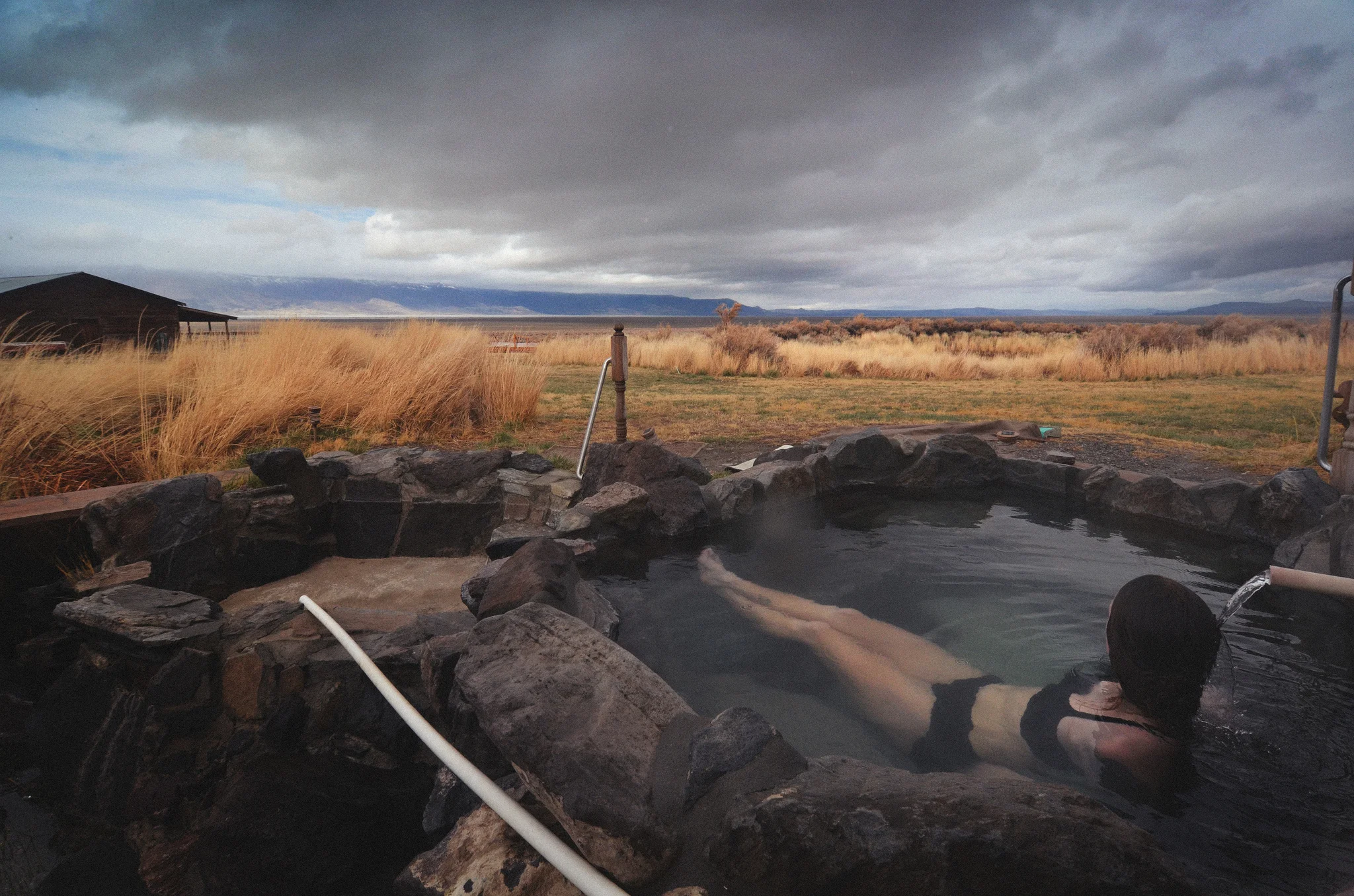
Summer Lake Hot Springs © Gabriel Amadeus
Beginning this segment the trail juts up steeply at first, then gradually gains 2,500 feet over 10 miles as you climb to Government Harvey Pass and Winter Rim along the Bear Creek drainage. A very important water resupply is at Currier Spring (Mile 111). Currier Spring is the only reliable water source in the Winter Rim segment until the pond at Farm Well campground (Mile 143).
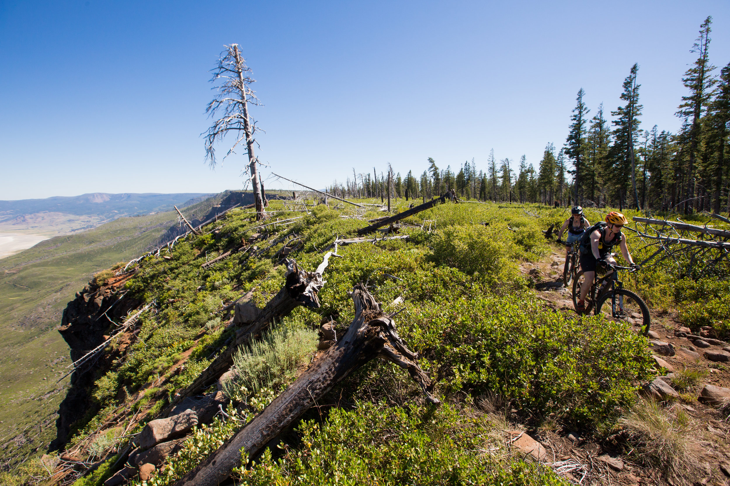
The next twelve miles may be some of the most scenic on the whole route. The Fremont National Recreation Trail follows the rim to Fremont Point and beyond, but is difficult and ponderous to follow. The trail has a lot of large chunky rocks and the brush encroaches heavily, making forward progress slower than expected.
Fremont Point hosts a reservable cabin, toilet, and small picnic area. And, of course, views of a huge swath of southeastern Oregon. After another eight miles of meandering along the rim, the Fremont National Recreation Trail veers westward away from Summer Lake and gradually descends to Farm Well Campground, eleven miles away. Before segment two is finished, you climb again, up the flank of scenic Hager Mountain and down to Road #28.
You can detour up to the peak of Hager Mountain (7,200 feet) at mile 146 for some spectacular 360º views and a reservable fire lookout. Once you hit Road #28, Silver Lake’s small store is a fast nine miles (paved) away, but don’t forget to make reservations at Cowboy Dinner Tree outside of town—their 30oz steak dinners are legendary.

Cowboy Dinner Tree © Gabriel Amadeus
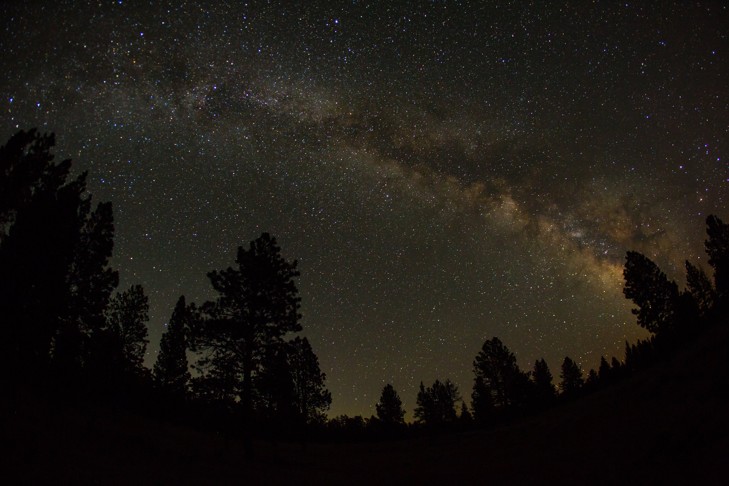
MAZAMA BLOWOUT
Segment 3 of 10
Silver Lake to Chemult
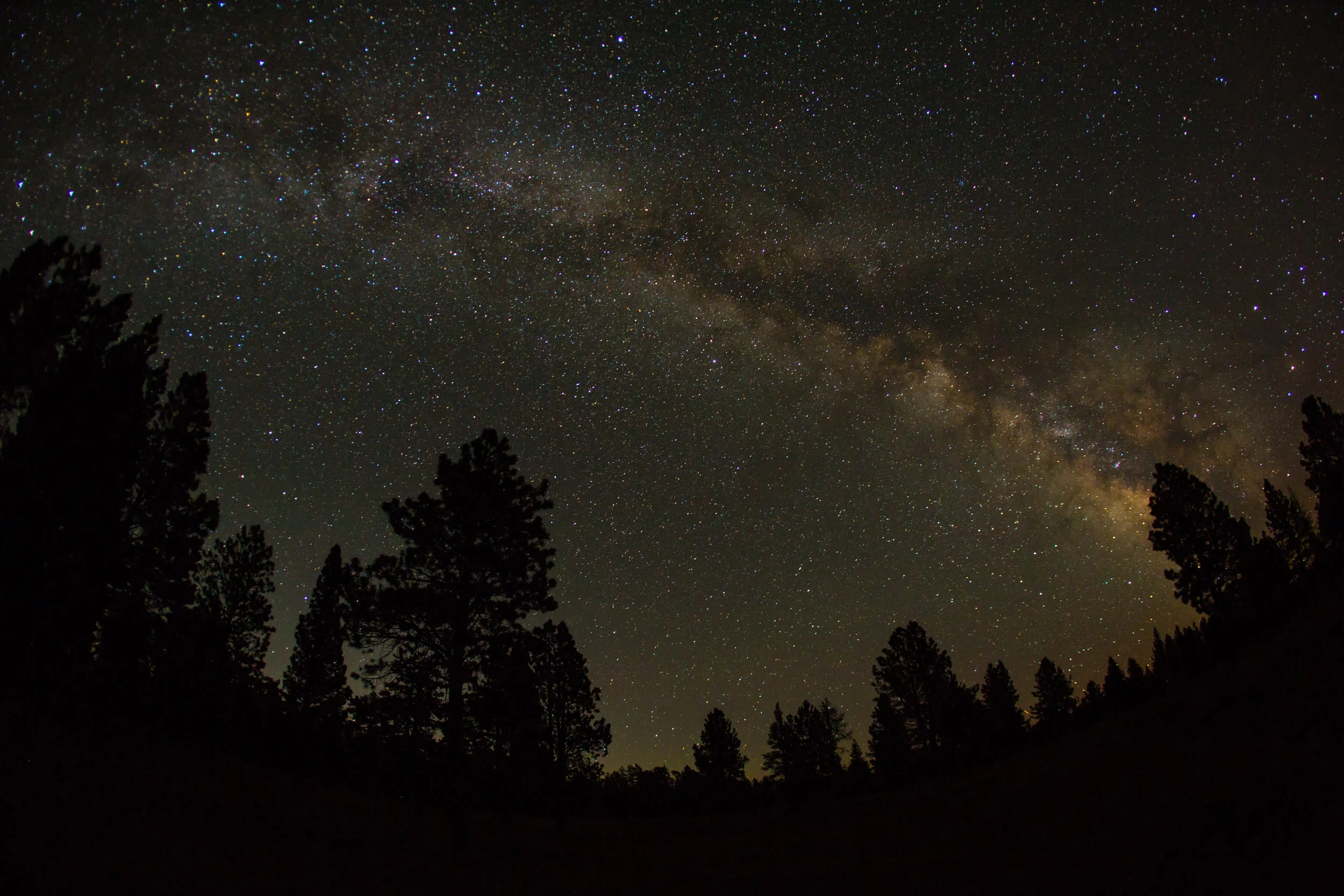
Night sky © Leslie Kehmeier
Segment length: 59 miles
Total climbing: +5,330 feet
Number of days: 1-2
3% Paved
55% Dirt road
42% Singletrack
95% Rideable
Physical difficulty: 6/10
Technical difficulty: 5/10
Bikepacking challenge: Intermediate
Longest stretch between resupply: 59 miles, 1-2 days
Longest stretch between water sources: 20 miles, 1 day
Resupplies
Mile 148: Silver Lake - Limited services: Silver Lake Mercantile & Motel, Silver Lake Café and Bar
Mile 206: Chemult - Limited services: gas station and small market
Commercial Lodging
Mile 148: Silver Lake Motel
Mile 206: Chemult - Several motels
The Mazama Blowout segment begins with a long climb to the summit of Yamsay Mountain and then descends through the fallout zone of the Crater Lake eruption. The most distinct change in landscape you’ll notice here is the prevalent red rock lining the roads and forest floor. These millions of acres of pumice scattered through the forest used to lay deep under the earth where Crater Lake now sits. About 7,700 years ago Mount Mazama blew up and the resulting debris field buried a huge swath of central Oregon. Today it’s covered in giant ponderosas and a network of quiet red roads.
This segment serves as an important connector between the Fremont Tier and the Willamette Tier—basin and range country to the famous old growth firs of Oregon. The forest is open and sparse, providing many good dispersed camping options. Once leaving the summit of Yamsay Mt, Jackson Creek (Mile 179) and Lost Creek Spring (Mile 199) are your only water sources.
In the small town of Chemult, you can rent a hotel room, eat some hot food, or grab some cold beverages and relax at Walt Haring Campground less than a mile out of town. Groceries are limited, but the Mountain Market has the best selection of fresh items and a small section of camping supplies.