

The Stiletsi and White Crane route seemed like a perfect route for a car-free adventure since it starts in The Dalles and does a 150-mile loop to Hood River, both of which are easily accessible by public transportation from Portland. My lack of recent bikepacking had me unsure how hard it would be for me or how long it would take– or if I should go at all. It had been so long that I had forgotten what I’m capable of. I was rusty riding loaded and every time I do it, it’s a shock how much harder it is than riding unloaded. But the perfect 70-degree sunny weather we were having in October wouldn’t last and if there was a weekend to do it, the time was now, whether it took me two days or three.
DAY 1 - Portland to Dufur
The drive through the gorge is one of my favorites, but usually, my attention is focused on the drive. The bus allows me to take in views of hillsides that plunge dramatically into the river below. I take videos; I browse Instagram; I daydream. Witnessing the new construction of the historic highway bike path has me thinking about what that will be like to ride from Portland to Hood River. That’s the beauty of taking the bus– travel time is yours.
Lucky for me, the bus dropped me off in The Dalles just down the street from my favorite taqueria - “Mi Pueblito.” I picked up two shockingly heavy burritos (one for Friday night dinner and one for Saturday lunch). So much for traveling light. I see a group of men fishing on a floating aluminum platform that seems like it was just built. I can’t see a fishing platform near the Dalles without thinking about how we flooded Celilo Falls in 1957. Today it’s a peaceful scene, and I take a photo. Reaching The Dalles Downtown, with its original architecture and its murals, I could easily linger taking photos of murals and historic buildings, but I know I need to get moving. I cross the main street and soon after steep paved roads take me to the residential streets above town. I admire my pedaling shadow as a hawk perches on one of a series of electrical towers - another reminder of the Dalles dam below.
I didn’t totally calculate how long it would take to get to Dufur. I still have my camera slung around my neck and my backpack feels heavier than I’d like. I ride a few more miles before I stop to readjust– moving my heavy burritos to my frame bag and stuffing my camera into my backpack. A nice lady in a pickup stops to ask if I need a ride. I say “No thank you. I’m just going to Dufur.” She says, “That’s where I’m headed.” It would be nice to be in Dufur now as the sun sets, but I stick to my plan. I’m out here to ride my bike. I climb a bit more, passing more cows and a field full of deer. I decided to hop off route in hopes of making better time. Of course, as soon as I’m on the highway, I wish I was back on the dirt roads. The highway feels steep and the shoulder seems smaller than I’d like.

Eventually I get back to the route and more dirt roads as I dip in and out of cold air pockets. As I arrive in Dufur there is a high school football game happening up on the hill. Part of me wants to head over to check it out. Though, I didn’t attend a single football game in high school. Why would I start now? I head to the campground and check out the situation. It’s pretty quiet. A few RV’s set up, some fairly low key fluorescent lights. I unwrap my burrito and then walk over the bridge to filter water from Fifteenmile Creek. I finish my burrito, set up my tent, and take a warm shower! Aside from the joyriding teens that cruise through the campsite, it’s a quiet night in Dufur and I’m glad to be out on this adventure. I let the sound of Fifteenmile Creek carry me off to sleep.
DAY 2 - DUFUR to PARKDALE
I awaken to homemade instant oatmeal packets and instant coffee. I’m surprised by how warm and how bright the morning is already. I’m eager to click off the paved miles and get to the dirt roads and singletrack. I’m excited for the upcoming miles, so my cadence is high and I’m pedaling probably harder than I need to. I feel slightly more accustomed to pedaling with this load now, and I’m delighted again to see my shadow being cast on the dry grasses as I admire the rolling farmland just West of Dufur.
Before I know it, the pavement gives way to dirt road. Upper Fifteenmile quickly turns from easy jeep track to rocky chunk and back. This is the part of the route that I was most curious about. Mostly it rides really well, with the occasional hike a bike and two creek crossings. Rather than soak my ride shoes for the day, I opt to wear my sandals for the crossing. Luckily it’s easy footing and only mid-shin deep. The beauty of following Fifteenmile Creek is that I don’t have to worry about filling up on water.


Soon I come to an open parking lot and I realize I’m already at the Lower Fifteenmile trailhead. It’s such a boost knowing that the only real unknown of today’s route is already done. This is the neat part for me…making the mental connection, actually getting to ride a trail that I helped clear a month ago. To suddenly be oriented and to be reminded of our trail work is a magical moment. As I push my bike from the parking lot up the steep access trail before the trail begins, I remember how low the branches hung, how it was impassable. Today it’s clear and I move with confidence. I’m reminded of lopping back encroaching vine maple. Soon I notice what was a tangle of trees before we made our cuts and it makes me smile. This is why I do trail work…This is that feeling of connection I had been searching for.


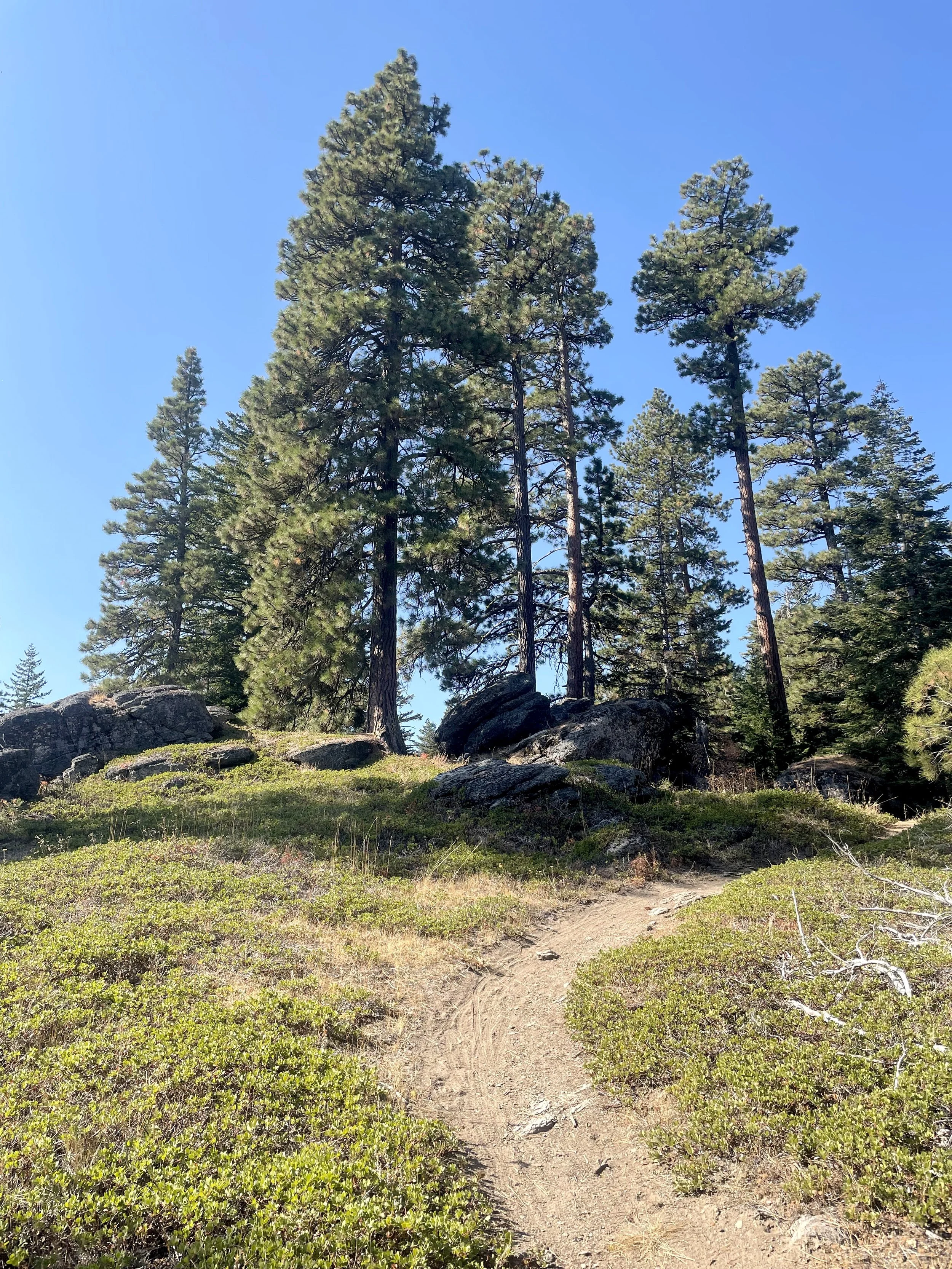
I come to a meadow and soon after I see a fire ring and a trail sign that says 5 miles to Fifteenmile Campground. That means two things: I’ve made it through the Lower Fifteenmile segment and I’m about to start the hard climb. We’ve been doing Fifteenmile as a loop from the Eightmile/Knebal trailhead for years and it’s a rowdy descent to the low point where I’m standing now and it’s a grunt of a climb back out. It always has been. I know the trail, I just don’t know what it feels like to climb it loaded…yet. After a quick bite and water fill-up, I begin the climb. I soon realize it’s more overgrown than I remember. I’m surprised since this is the more popular part of Fifteenmile. Before long I’m off the bike and it’s clear that most of this climb will be off the bike. It’s just too steep. Three quarters of the way up my left hip and calf start cramping a bit. Extended hike-a-bike is hard, though mostly my body has held up really well until this point. I’m grateful for that.


The climb takes about 3 hours up for me before I reach the top. At some point, I realize I haven’t been eating much. I didn’t want to eat much on the climb, but after three hours I’m getting a bit depleted. I quickly rip open my burrito and scarf down three bites. Close to Fifteenmile campground, I run into my first human - a smily lady trail running. I say something stupid like “you’re the first person I’ve seen all day”. She just gives me a wave and keeps running. The next person I encounter is a mountain biker descending at top speed. Luckily, I was already off the bike and stepped right. He says “Thanks” and is past me in a blur. Once at the top it’s a fun and flowy descent down to where you cross FR-44 and shortly thereafter you’re at the Knebal/Eightmile parking lot and trailhead.

After dismounting I quickly see Daveed. He’s riding with a couple of friends and they ask a bit about my ride and they offer pistachios, chocolate and a banana. I’m enjoying the break and it’s fun to see some friendly faces. They let me know that there was a trail running race happening, and they turned back.
After some chatting I’m back on the bike and soon I’m off the bike hiking the steep dusty climb of the Knebal Springs trail. At this point, I’m feeling anxious. I’m optimistic about making it to Parkdale, but the extended climb was a bit grueling. I can feel a bit of fatigue, but I’m confident I can push through. I know Surveyors can be punchy and I’m not sure how it will feel on a loaded hardtail. I still need to focus on this fun and dusty descent. As soon as I see the road that parallels the superconnector, I make a quick exit to enjoy the fast dirt road descent. One of the benefits of knowing the area well enough and making my own choices. I’m making good time now and before I know it I see the entrance to Surveyors. Again, I’m reminded of a trail work party with 44 Trails years ago where we worked on this connector. It’s fun to be in a zone with so many memories and connections. It’s one of the reasons I was drawn to this route –it ties together so many experiences and at the same time it’s a brand new experience that’s letting me mentally connect all the east side gravel rides, the 44 Trails mountain bike rides to all the trail work we’ve done.

I never see any trail runners or evidence of a race, aside from some dayglo trail markers. I fantasize about running into a feed station that’s packing up after the last racer has been through. They have a few too many treats and gummy bears and ask me if I need anything. But the truth is I have plenty of food and the riding is going really well. At this point in the day, I’m feeling confident on the bike, I’m riding well and I know where I’m going. I get to the point on Surveyors where there was an old lookout. I know that’s the crux of the trail when you’re heading North. It’s not all downhill from here, but it trends that way, and after some fast and rowdy descending I reach the Oakridge trail intersection. It’s all downhill to Parkdale now. It’s as fast, rocky, and full of switchbacks as I remember. I clean a couple of switchbacks and dab a couple of others. The right-handers are always awkward for me. Something to work on, I suppose.


Once I exit Oakridge, I’m flying on the pavement. I luck out on 35 and it’s car-free while I’m on it. I make the turn into Tollbridge campground and since it’s not peak season, I have my pick of tent campsites. None are particularly inspiring. I find one that’s flat enough and still close enough that I can hear the East Fork of Hood River. I pay my $25 and quickly sit down at my picnic table and devour the last of my burrito. It’s divine. I balk at finding quarters to take a shower, especially after the nice free shower in Dufur. Instead, I head over to the river and take an ice-cold splash bath. It feels great to wash the trail dust off and soak my legs in the cloudy blue snowmelt.
After I set up my tent and get my bags off the bike, I pedal into Parkdale and hit McIasaac’s for chocolate milk, fizzy water, and greek yogurt for some extra protein. I grab some overpriced triple-A batteries for my SPOT device. I chug the milk while waiting for the long line of locals buying their Saturday night beers. I always feel mixed emotions being back in a town after a long day out on the trail. On one hand, I’m grateful to be in a well-stocked store, able to buy whatever I crave. On the other hand, it feels like being stuck in traffic, but it’s just a feeling and once I’m out of the market, the feeling is gone and I’m free again. Back at camp, I drink my drinks and eat my yogurt. I’m still undecided about what I’m going to do tomorrow. Today was hard, but I still have plenty of energy for more. I’m leaning towards just doing the official OTT route, since I haven’t ridden that yet and I want to know what feels like after a full day of riding. I decide to sleep on it and make the call in the morning.
DAY 3 - PARKDALE TO HOOD RIVER
The morning is clear and slightly cooler than Dufur was. I slept pretty well and wanted to linger in my sleeping bag. I felt less urgency to get on the bike than yesterday, knowing that today should be easier than yesterday. I made my usual instant oatmeal and coffee and started packing up camp. As I pedaled toward Parkdale, I realized my legs feel pretty good. I love the view from Parkdale and I stop for a few snaps –Mt. Hood looms large over apple and pear trees. In Parkdale, I spied a new coffee shop called Moby. It looks great - and if you trust Google reviews (5 stars out of 38 reviews!) it’s a winner. But today, I don’t need an extra coffee so I just make a mental note for a future trip. I stopped by McIsaac’s again for a sandwich to go. The deli is well-stocked this morning. I stash my lunch in my pack for later and head out for the day.


I’m surprised by how much descending there is heading out of Parkdale. I passed orchards with workers in the back of a truck heading to work for the day. I’m grateful to have the day to just pedal my bicycle. Today I’m in a much more leisurely mood and I like not knowing exactly what route I’ll do. I’ll make that call when I get to the turn. I suppose that’s one of the advantages of riding solo. I only have to negotiate with myself. I stop for photos - a weathered barn, orchard trees, a semi with an oversized baked potato sculpture. Yes…really. Soon, I cross over the West Fork of Hood River and it’s decision time. I take a right onto Kingsley instead of continuing on Dead Point road. It’s a nice gravel road that climbs steadily, in and out of clear-cut, but mostly in the trees. After yesterday, this seems perfect to me - a steady gravel climb.


While yesterday was full of personal connections and memories of trail work, today is a new experience. I’m eager to see what Timber Trail thru riders experience. I try to imagine what this climb would feel like if I had been riding for 10, 15, or even 20 days. Would this climb excite me? Ready for pizza and a beer? Or sad that it’s ending, happy to have one more climb, one more overlook before a dramatic descent to Hood River? I stop at a creek to filter and eat some RX bar. So far, I’ve only come across one pickup coming towards me, and otherwise, I’ve been alone, which is great.
I round a bend and suddenly I’m back to pavement and it’s time for the climb to Kingsley. Luckily there isn’t too much car traffic. Of course, there is the occasional pair of motos descending, or truck powering up. Sweat is pouring down out of my helmet now and dripping onto my bike frame. Whatever benefit I got from being on pavement is completely overshadowed by the steepness of the road. I know the climb will top out at Kingsley, but it feels like it just keeps going and going. Luckily, the weather is mild, but I still seek whatever shade I can find, even if it’s on the left side of the road. I make the last push, reminding myself that there is a bit more climbing after the reservoir, but after that, it’s all downhill. When I reach the reservoir, I sit on a concrete platform and eat half of my sandwich. I can tell I was hungry by the way my body seems to absorb the food. Not much is happening here on a Sunday. A couple unloads mountain bikes and pedals off beyond the reservoir. I can’t help but wonder where they’re riding.


This part is brand new to me. I have no idea how to connect to Post Canyon. Soon the forest road climb comes to an end in what looks like a cross between a quarry and a decommissioned road. I pedal up a steep embankment, since the track tells me to, but it’s clear things have changed recently. I look back to the bottom of the embankment and see what looks like a rough trail that heads into the woods. That must be it. It’s a trail, but it’s chunky with rocks and the rocks only increase as the trail continues. The track says I’m on route, so I continue, but I have that nervous feeling. My brain still doesn’t quite get it. It’s so completely different from all the trail I rode yesterday and the roads I pedaled today. I’m having one of those “why is this the route?” moments, but at the same time, I’m fine. I simply notice my discomfort and keep moving forward. As I push up the last bit of rocky trail, I look back and see an ATV sign that indicates the trail is a double black diamond moto/ATV trail. That seems right.


As soon as I reach the gravel access road, I hear the excited voices of a trio of weekend Post Canyon riders. They proudly tell me they’re doing their longest mountain bike ride ever. They ask what I’m up to and I tell them about my little adventure. A bit more chatting and we realize we’re all going for it, pushing our boundaries a bit. I have them to go ahead of me since they’re unloaded. The outer limits of Post Canyon are untamed and feel more suited to motos than mountain bikes. Post Canyon is in classic late season mode as I navigate around brake bumps and kick up moon dust. I have to stop several times to check my track with all the intersections. I’ve ridden Post enough to know I don’t have the patience to end up in a zone that I have to climb out of. I run into a pair of families at their pickup –they’ve got heads down studying cell phone maps to figure out their trail. I find my trail and push off unnoticed. I run into many more riders who point me towards Kleeway. They tell me that’s the most direct, least technical way out of Post Canyon. I bobble and catch myself as I realize just how slippery that moon dust can be. Once I get my flow on Kleeway I’m enjoying myself, but soon I’m at the trailhead and I sail past folks putting bikes back on their racks. It’s a fun and fast descent towards Hood River. I spy a fun groomed berm on the side of the road and carve it. Soon, I’m out of the woods entirely and making turns on the farm roads that turn to subdivisions. I make a quick pitstop at Rosauers grocery store for sushi and chocolate milk. Weird combo, I know. Cravings are like that.

This is where the route gets interesting. The Indian Creek Trail begins just after 12th street. The first part feels like a city park tucked into residential back yards. I later learned that the trail has two separate sections with plans to connect them. I’m amazed by the sight of the wooden flume and later learned that the trail “served as the conduit for the wooden flume which brought water to a fruit cannery downtown.” Soon the trail plunges, and I’m flying down to the far east end of town, with big views down to the river and back towards the pear orchards. What a wild ride! All these years riding in the area and there are still new things to discover!
I pushed my bike around downtown, watching people strolling through town, eating at cafes. I head down to the riverfront to see what’s new with the breweries. Pfriem has been joined by Ferment Brewing Co. There are no shortage of places for OTT riders to indulge after their rides.
All in all, I think the Stiletsi and The White Crane makes a perfect weekend route and one that’s very much doable without a car. The good news for CAT bus riders like myself is that the bus stop is right down the street. An hour later the bus rolled back to Gateway Transit center and I pedaled the remaining miles back home. I feel good knowing that I did what worked best for my weekend and my current level of fitness, while still pushing myself a bit. That’s the thing about bikepacking: choose your own adventure. Oh…and leave your car at home if you can. It’s so much better that way!
